Monday, May 29, 2023

SPRING WILDFLOWERS AND PONIES IN ENGLAND’S NEW FOREST, Guest Post by Susan Kean

Spring violets, the New Forest, England

My friend Susan Kean, an excellent photographer, recently visited the New Forest in England, when wildflowers were everywhere and new foals were frolicking in the meadows. She has graciously agreed to share some of her photographs with The Intrepid Tourist.

Meadows like this one in the New Forest are places where meadowlarks and other creatures can survive.

My favorite flower, the cowslip. They have an incredible smell.

The New Forest is one of the largest remaining tracts of unenclosed pasture land, heathland and forest in Southern England, covering southwest Hampshire and southeast Wiltshire. It was proclaimed a royal forest by William the Conqueror, featuring in the Domesday Book.

Acres of bluebells.

Susan writes: The bluebell seems to be England’s answer to the California poppy. They grow in surprising places but things have to just right for them to thrive.

Acres of gorse in New Forest.

No visit to the New Forest is complete without pony pictures. Local people (commoners, that is, people who own part of the Common land) are free to graze their animals in the New Forest. This came from the time when King William I, around 1100, established the forest as a royal hunting preserve and the people who lived there were not allowed to fence their properties. They were, however, granted rights to let their animals graze freely. Those rights are still in place today!

New Forest ponies.

Even a wet day in the New Forest was great for pony watching.
There were lots of young foals. 

Mother and foal.

This foal was very curious about me but mom kept an eye on me.
Baby foal would have come right up to me but I decided Mom might not trust me and could give me a hard kick. So I moved away.

Even ponies have to chase after their children sometimes.
For more about sightseeing in Hampshire, see Anita Withrington's guest post about the Alice in Wonderland topiary at the Hampshire Gardens and the National Motor Museum (Feb 26, 2023).

Bluebells, New Forest.


Monday, May 22, 2023

DINOSAURS AND MORE at the Calgary Zoo, Alberta, Canada

Dinosaur at the Calgary Zoo with the skyline of the city in the distance.

How many zoos have both real wild animals AND dinosaurs? Not very many. But at the Wilder Calgary Zoo and Prehistoric Park in Canada you can not only see giraffes and hippos and a host of other wild animals, but also models of life-size dinosaurs lurking among the trees and bushes, just as they might have been in real life millions of years ago.

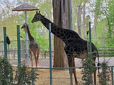
Like the sauropods of dinosaur times, giraffes use their long necks to reach their food.

On an overcast/occasionally rainy day in May, I visited the Calgary Zoo, dodging the raindrops along with groups of school children on class visits to see the animals. The zoo straddles the Bow River, with the Canadian Wilds (closed on the day of my visit) and Dinosaur Park sections on the same side as the entrance and parking area, and, on the other side of the pedestrian bridge, Destination Africa, the Dorothy Harvie Gardens, and Exploration Asia. All exhibits have both inside and outside viewing areas, making the zoo accessible in winter and on rainy days.

A wild Canada goose takes a stroll in the rain through the Calgary Zoo.

After buying my ticket, my first stop was at the Penguin Plunge where I watched penguins cavorting in their outdoor pool, perfectly at home on the cool, wet day. I then proceeded to Destination Africa to see the giraffes, hippos, porcupines, zebras, giraffes, ostriches and other African wildlife. 

Close-up encounter with a hippo in Destination Africa.

A group of children were clustered around the viewing window of the hippo tank, delighted by a young hippo who was just inches away.

Gorilla feet--note the black toenails!

While the enclosures give the animals plenty of personal space, they also allow visitors the occasional closeup encounter (on the other side of the glass.) One of the gorillas had chosen to nap so close to the window that you could see the details of its toes and fingers.

Lily pond in the conservatory.

By the time I got to the Dorothy Harvie Gardens, the rain was pouring down, so it was the ideal time to go inside and visit the conservatory. 

Swallowtail butterfly and chrysalis.

I n the same building I then went to the butterfly enclosure, where I watched a beautiful butterfly just emerging from its chrysalis.

Cryodrakon (wingspan 33 feet)

When the rain let up, I went back outside and followed the path to the Asian animals (gibbons, tapirs, a Bactrian camel and more) and then across a suspension bridge to the Prehistoric Park, where I was greeted by a giant pterosaur, whose wingspan in real life would have been the size of a small airplane. 

This dinosaur, whose name means "royal horned face" lived in Alberta 68-67 million years ago.

Dozens of dinosaurs line the paths through this part of the zoo, all with helpful signs and painted in bright patterns and colors. 

Corythosaurus grew to be 30 feet long.

We don’t yet know what color most dinosaurs were, but it is likely that their colors varied just like they do on the skin of lizards or the feathers of birds today.

Close, but of reach!

At the end of my visit I had a sandwich and cocoa in the zoo cafĂ© near the entrance. The cafe is part of an extensive gift shop.  I enjoyed seeing all the animals at the Calgary Zoo, but what is truly unique about the zoo are the dinosaurs. With a little imagination one feels transported in time to millions of years ago when dinosaurs were alive.  

Getting there:

The zoo was a short taxi ride from my downtown hotel, but I could have taken the train. (There is a stop right at the zoo entrance.) I asked for a zoo map at the ticket window but found out that the zoo no longer provides paper maps. You can download a zoo map to your phone, or, as I did, refer to the large map signs posted at strategic spots around the zoo.

African porcupines.


Monday, May 15, 2023

A TRIP THROUGH TIME: HOODOOS AND FOSSILS in the Badlands of Alberta Canada

Hoodoos, near Drumheller, Alberta, Canada

Over the eons the Red Deer River has cut a valley into the Alberta plains in Western Canada, revealing layers of rock going back to dinosaur times. Wind and rain have carved some of these rocks into giant mushroom shapes called hoodoos when the upper layer of rock erodes more slowly than the layer beneath. 

Stairways lead to viewing platforms for the hoodoos.

In early May, my husband Art and I visited Alberta, getting a close look at some of the hoodoos and taking a self-guided geology walk near the Royal Tyrell Museum in Drumheller.

Alberta wheat fields.

To get to Drumheller we drove an hour and a half from Calgary across the Alberta wheat fields—an endless vista of golden plains dotted with the occasional silo or homestead. Then suddenly, just before arriving at the town of Drumheller, the road plunged down into the Red Deer River valley, almost as if the earth had suddenly cracked open to show us the history of its insides.

Each layer of rock is a story from the past. White sandstone was once sand at the bottom of a river. Grey-brown layers were once silt and mud. Black is coal, formed by the remains of plants. Chemical reactions in the buried sediments form the dark iron-stones.

The Red Deer River Valley was formed by floodwaters from melting glaciers during the last Ice Age, 10,000 to 15,000 years ago, and it has been eroding ever since.

Signs with history of the area are posted throughout the valley.

The black layers of the rock walls are coal. The coal mines that once drew people to this valley are no longer operating. Other layers are filled with dinosaur bones and other fossils of the Dinosaur Age. The fossil discoveries in Alberta have been spectacular and many are on display at the Royal Tyrell Museum in Drumheller. (The museum will be the subject of another blogpost.) 

A map of the trail and location of interpretive signs.

But just outside the museum is the Badlands Interpretive Trail, a one-kilometer loop walk that provides a close look at the local geology and information about the area--a good introduction or follow-up to visiting the museum.

Crocuses blooming along the trail are a sign of spring.

The climate of the Red Deer River in the late Cretaceous, 72 million years ago, was warm and moist, like Florida today. Today, the valley is seasonally warm and semi-arid. On the day we visited, in late May, the weather was cool and overcast, ideal for taking a walk.

Along the trail numbered signs explained what we were seeing.
These small boulders made of igneous rock were brought from elsewhere and dropped by a melting glacier.

Hoodoos like these on the museum trail are found throughout the badlands.

This fossilized tree stump from a giant redwood was part of a forest that once grew here.

Most of Alberta’s dinosaur remains are found in the Badlands and river valleys where Cretaceous-aged sediments are exposed. Today, wind, rainfall, and snow melt continue to erode the badlands, exposing more fossils with each passing season. We did not see any fossil remains on our walk, but we could imagine what the Earth was like millions of years ago when dinosaurs made Alberta their home.

Walking the dinosaur trail.


Monday, May 8, 2023

IMAGES OF HAWAII'S PAST: PETROGLYPHS AT WAIKOLOA on the Big Island of Hawaii


On our recent visit to the Big Island of Hawaii, we stopped to view the Waikoloa Petroglyph Preserve, a historic site sandwiched between condominiums and golf course fairways,  a short walk from the Waikoloa shopping center. A sign with the following information greeted us at the beginning of the path through the petroglyph field:


This collection of images engraved in stone is one of the major concentrations of ancient rock carvings (petroglyphs) in the Hawaiian Islands. Boundaries were not crossed casually in old Hawaii, and the thousands of surface carvings, just north of the border between the ancient kingdoms of Kohala and Kona, suggest that many may have a religious or commemorative meaning to the event of crossing that border.


Groups waiting for permission to cross, or armies poised to defend the border or attack it, made simple encampments using cave shelters and rock wall windbreaks. Some of the “C”-shaped windbreaks may still be seen in an unrepaired state.


Most petroglyphs were made with a sharp stone held as a chisel and struck with a hammer stone; the lines being further incised with a sharp rock fragment. Others were made by rubbing a blunt stone against a lava surface, or by bruising the surface by pounding, breaking the natural glaze which forms on cooling lava to reveal the granular interior. Erosion of the edges has blurred the most ancient carvings, and some damage has been caused by persons making rubbings (a practice not permitted without special permission.)


We can only speculate about the meanings of the petroglyphs. Some of the information given to early western observers is contradictory, perhaps deliberately misleading to preserve the secrecy of meanings not intended to be shared. But these carvings were not idle “doodling.” In the Polynesian world, every expression had significance and purpose. The pictorial images may have commemorated events, or served as representations or guardian spirits carved as prayer objects, or they may have been heraldic devices of clans. 


Concentrations of dots, lines, and circles may have recorded the number of persons in a group, or days of travel, or prayers made, or the number of trips made past this place, as an indelible communication to posterity. Here, travelers might come upon the signature of an ancestor, and add their marks.

The presence of Hawaiian names in Roman letters, of dates, and of images of sailing ships and horses, poignantly marks a time of change. The most recent carving is more than a century old. Because the trail was primarily used by commoners, these carvings may not have profound relevance to the main events of ancient Hawaii. But all petroglyphs are treasured as enigmatic but tangible evidence of the old culture, irreplaceable and priceless.

Transcribed from information sign at Waikoloa.

The Waikoloa Petroglyph Field is located between two golf course fairways, a short walk from the parking area and gas station adjacent to the Waikoloa shopping center. Go to the link to see photos and detailed instructions on how to get to the site. Be sure to wear a hat and sun protection. There is no shade on the petroglyph field and the sun can be hot, especially at midday.


Monday, May 1, 2023

WHERE LAVA MEETS THE SEA, Exploring Hawaii’s Tide Pools


Tide pools, Kona, Hawaii

When visiting the Big Island of Hawaii, one is constantly reminded of both its volcanic past and present. In many places, vast fields of black rock—once molten lava—cover the landscape. Here and there small plants are taking a foothold. Along the coast, where lava once reached the ocean and hardened into rock, waves pound the shore, creating cavities for tiny animals and pools for fish and crabs.

Sea urchins.

On our recent trip to the Big Island, our hotel in Kona (The Royal Kona Resort) overlooked the sea. Along the edge of the sea was a rocky ledge. Wearing sturdy shoes and taking care where I stepped, I ventured out onto the rocks to get a closer look at the creatures that were making their homes in the tide pools. 

At the outer edge of the shore, a constant stream of water washes in and out of the pools as waves break. But at low tide, the water of the inner pools is still and clear. In some I saw tiny fish dart from crevice to crevice. In others, sea urchins clung to the rocks, their spiny exteriors making them look like living pin cushions.

Sea cucumber.

As I peered under an overhanging rock, I spotted several sea cucumbers, their tentacles spread at the end of their long bodies. Tiny crabs skittered across the rocks above, but as soon as they detected my shadow they disappeared into cracks. The crabs are preyed upon by birds, who leave their empty exoskeletons behind. 

Crab remains left on a rock.

I had hoped to see sea turtles swimming or resting near the shore, as I had on previous trips, but this time none appeared. However, the variety of creatures that I did discover were reward enough and yet another example of the myriad ways that life exists on our planet.

Bright yellow seaweed (Ahnfeltiopsis coccina) is called Limu Aki Aki in Hawaiian.  Common in Hawaii, it is edible.

Note
: Public access to Hawaii's shore is marked with signs at various places along the coast. I explored the tide pools near my hotel (The Royal Kona Resort) following the signed walkway to the beach at the point where Kahakai Road turns inland.  For a guide to the best tide pools near Kona, click HERE.

A colony of helmet urchins (Colobocentrotus atratus).
Chunks of coral, bleached and rounded by waves, stand out against the black lava.

View of the reef near the Kona airport, as seen from the plane window shortly before landing.